West Coast Braces for Catastrophic Flooding as Bomb Cyclone Combines with Atmospheric River
A rare and powerful bomb cyclone wreaked havoc across the Pacific Northwest this week, leaving a trail of destruction and widespread power outages. Now, a new and potentially even more dangerous threat looms as the storm merges with an atmospheric river, unleashing torrential rains and life-threatening flooding across parts of the West Coast.
Bomb Cyclone Leaves Devastation in Its Wake
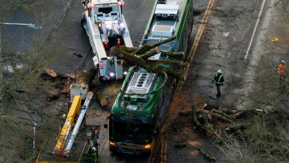
The bomb cyclone rapidly intensified earlier this week, bringing hurricane-force winds of up to 101 mph to parts of Washington and Oregon. At least two people lost their lives in Washington due to falling trees, and emergency crews were stretched thin as the storm caused extensive damage to homes and infrastructure.
Power outages were severe, with over 290,000 homes and businesses in Washington left in the dark. Puget Sound Energy reported that over 450,000 customers experienced outages in a “mass outage event,” with restoration efforts expected to take several days. Similar disruptions were reported in British Columbia, where over 70,000 were without power.
Seattle and surrounding areas were among the hardest hit, with fallen trees, damaged traffic signals, and blocked roads creating chaos. “This is one of the worst windstorms we’ve had in recent memory,” Issaquah Mayor Mary Lou Pauly said.
Atmospheric River Intensifies Flood Risk
As the winds subsided, attention shifted to the merging of the bomb cyclone with a powerful atmospheric river—a narrow but intense band of concentrated moisture that is now dumping relentless rain on the region. Northern California and parts of the Pacific Northwest are at the highest risk, with the National Weather Service issuing a rare level 4 of 4 high-risk flood warning for Thursday.
The Weather Prediction Center warned of “life-threatening flooding across coastal Northwest California” as the atmospheric river strengthens, with up to 16 inches of rain expected in some areas over 48 hours. The northern San Francisco Bay Area, particularly north of the Golden Gate Bridge, is forecast to receive more than a month’s worth of rain, causing urban flooding, river surges, and dangerous debris flows.
Higher elevations in Northern California are seeing precipitation fall as snow, with several feet expected by the end of the week. Interstate 5 in Siskiyou County was temporarily closed due to treacherous conditions, and chains are required on Interstate 80 in the Sierra Nevada.
Another Bomb Cyclone on the Horizon?
To make matters worse, meteorologists are monitoring the potential development of another bomb cyclone off the West Coast by Friday. While this second storm is expected to be less intense than the first, it could still exacerbate the region’s flooding risks and bring additional damaging winds.
Communities on High Alert
Emergency services are urging residents to remain vigilant as the dangerous weather system continues to batter the region. Rockslides, debris flows, and flash flooding are expected to make travel perilous, while the ongoing power outages are straining resources.
As the West Coast battles one of the most significant weather events in recent years, officials stress the importance of preparedness and caution in the face of this unprecedented storm.


